
Dangerous Cold and Strong Winds Return This Weekend
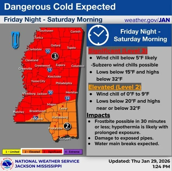
Another surge of dangerous Arctic air will impact the area this weekend, bringing very cold temperatures, gusty winds, and hazardous wind chills. Wind chills are expected to fall below 5 degrees, with subzero readings possible in some locations.
These conditions can become life-threatening quickly. Frostbite may occur in minutes, and hypothermia is likely with prolonged exposure, especially for those without adequate heat. The cold also increases the risk of burst pipes and water main breaks, particularly where insulation or heat is limited.
Power Outages & Wind Concerns
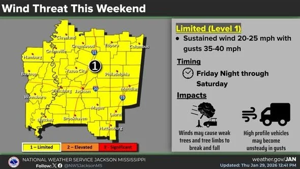
Ongoing power outages in some areas will make the cold even more dangerous. Strong north-northwest winds arriving Friday night through Saturday may complicate remaining restoration efforts.
Wind gusts could become strong enough to damage trees, especially those already weakened by the recent ice storm. Additional tree damage could lead to new power outages. As confidence in the forecast increases, a Wind Advisory may be issued.
Another Cold Blast Saturday Night
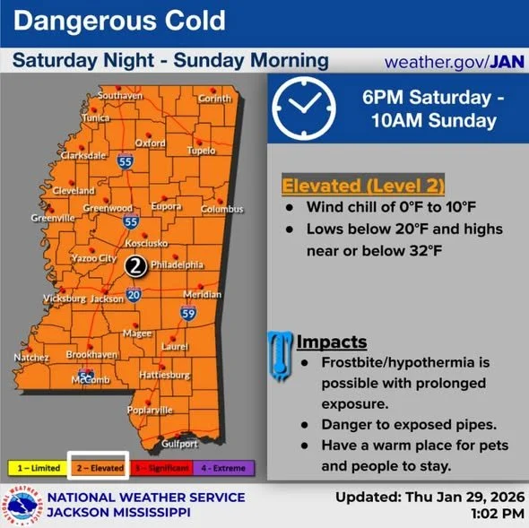
The cold intensifies again Saturday night into Sunday morning, with wind chills ranging from around 3 to 10 degrees, particularly across eastern areas. Frostbite and hypothermia risks remain high, and pipe damage will continue to be a concern. Forecast Details
Friday Night:
Mostly cloudy, low around 17°. North-northwest winds 10–20 mph, gusts up to 30 mph.
Saturday:
Mostly sunny, high near 30°. North-northwest winds 15–20 mph, gusts up to 35 mph.
Saturday Night:
Mostly clear, low around 15°. North-northwest winds 5–15 mph, gusts up to 20 mph.
Sunday:
Sunny, high near 42°. Light north-northwest wind around 5 mph.
Sunday Night:
Partly cloudy, low near 22°. Calm winds.
Monday:
Sunny, high near 53°. Calm wind becoming west around 5 mph.
Monday Night:
Mostly clear, low near 28°. Calm winds.