
7-Day Forecast 7-26-25
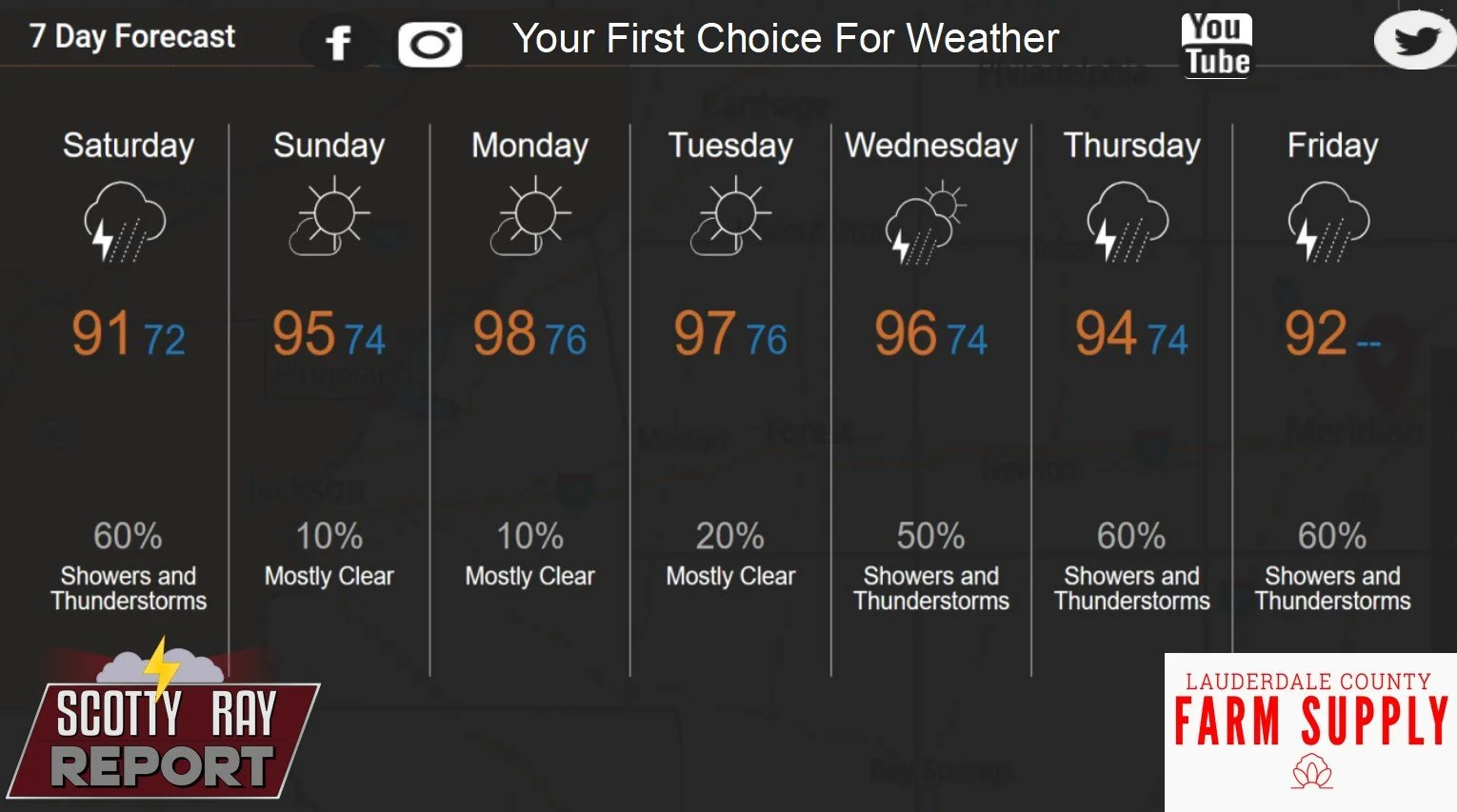
Today
Showers and thunderstorms likely, mainly between 3pm and 5pm. Partly sunny, with a high near 92. Heat index values as high as 101. South wind 5 to 10 mph. Chance of precipitation is 60%. New rainfall amounts between a quarter and half of an inch possible.
Tonight
A 30 percent chance of showers and thunderstorms, mainly before 7pm. Mostly cloudy, then gradually becoming mostly clear, with a low around 72. South wind around 5 mph becoming calm in the evening.
Sunday
Sunny, with a high near 96. Heat index values as high as 106. Calm wind becoming west around 5 mph in the afternoon.
Sunday Night
Clear, with a low around 74. Calm wind.
Monday
Sunny and hot, with a high near 99. Calm wind becoming northwest around 5 mph in the morning.
Monday Night
Mostly clear, with a low around 76. Northwest wind around 5 mph becoming calm.
Tuesday
A 30 percent chance of showers and thunderstorms after 1pm. Sunny and hot, with a high near 99. Calm wind becoming north around 5 mph in the morning.
Tuesday Night
A 20 percent chance of showers and thunderstorms. Partly cloudy, with a low around 75. North wind around 5 mph becoming calm.
Wednesday
Showers and thunderstorms likely, mainly after 1pm. Mostly sunny, with a high near 95. Calm wind becoming east around 5 mph in the afternoon. Chance of precipitation is 60%.
Wednesday Night
A 40 percent chance of showers and thunderstorms before 1am. Mostly cloudy, with a low around 74.
Thursday
Showers and thunderstorms likely. Mostly sunny, with a high near 93. Chance of precipitation is 70%.
Thursday Night
A 40 percent chance of showers and thunderstorms. Partly cloudy, with a low around 74.
Friday
Showers and thunderstorms likely. Mostly sunny, with a high near 93. Chance of precipitation is 70%.