
7-Day Forecast 10-4-26
Today
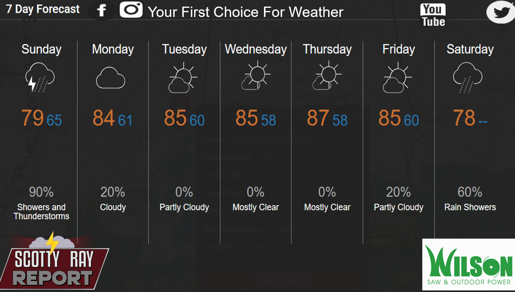
Showers and thunderstorms likely, then showers and possibly a thunderstorm after 11am. Patchy fog before 7am. High near 80. Light east northeast wind becoming north northeast 5 to 10 mph in the morning. Chance of precipitation is 90%. New rainfall amounts between a tenth and quarter of an inch, except higher amounts possible in thunderstorms.
Tonight
A chance of showers and thunderstorms before 10pm, then a chance of showers between 10pm and 1am. Cloudy, with a low around 66. North northeast wind 5 to 10 mph. Chance of precipitation is 40%.
Monday
A slight chance of showers between 2pm and 4pm, then a slight chance of showers and thunderstorms after 4pm. Mostly cloudy, then gradually becoming sunny, with a high near 85. North northeast wind 10 to 15 mph, with gusts as high as 20 mph. Chance of precipitation is 20%.
Monday Night
Mostly clear, with a low around 61. North northeast wind 5 to 10 mph.
Tuesday
Mostly sunny, with a high near 85. East northeast wind 5 to 10 mph.
Tuesday Night
Mostly clear, with a low around 60. East wind around 5 mph becoming calm in the evening.
Wednesday
Sunny, with a high near 86. East northeast wind 5 to 10 mph.
Wednesday Night
Mostly clear, with a low around 58. East northeast wind around 5 mph becoming calm.
Thursday
Sunny, with a high near 87. Light northeast wind becoming east northeast 5 to 10 mph in the morning.
Thursday Night
Partly cloudy, with a low around 58.
Friday
A 20 percent chance of showers. Partly sunny, with a high near 85.
Friday Night
A 30 percent chance of showers. Mostly cloudy, with a low around 60.
Saturday
A 50 percent chance of showers. Mostly cloudy, with a high near 78.