
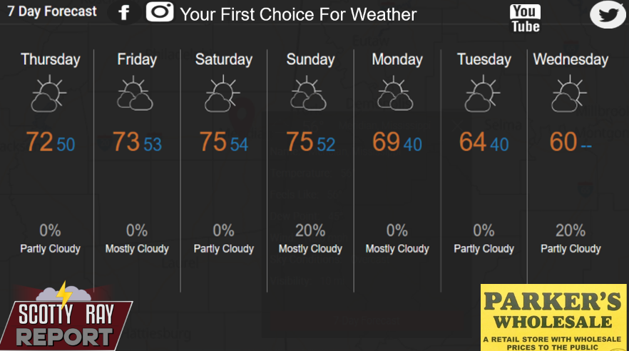
Temperatures will remain mild through the weekend, but rain chances increase Sunday and Monday. Cooler weather moves in early next week, bringing highs back into the 60s and nighttime temperatures into the 40s.
Today
Mostly sunny, with a high near 72. East northeast wind 10 to 15 mph, with gusts as high as 20 mph.
Tonight
Mostly cloudy, with a low around 50. East northeast wind 5 to 10 mph.
Friday
Partly sunny, with a high near 73. East wind around 10 mph.
Friday Night
Partly cloudy, with a low around 53. East wind around 5 mph.
Saturday
Mostly sunny, with a high near 75. East southeast wind 5 to 10 mph.
Saturday Night
Partly cloudy, with a low around 52. East wind around 5 mph becoming calm in the evening.
Sunday
A 20 percent chance of showers. Partly sunny, with a high near 77. Calm wind becoming south around 5 mph.
Sunday Night
A 30 percent chance of showers and thunderstorms, mainly before midnight. Partly cloudy, with a low around 51. Calm wind becoming north northwest around 5 mph.
Monday
Partly sunny, with a high near 69.
Monday Night
Partly cloudy, with a low around 42.
Tuesday
Mostly sunny, with a high near 65.
Tuesday Night
A 20 percent chance of showers. Mostly cloudy, with a low around 39.
Wednesday
A 20 percent chance of showers. Partly sunny, with a high near 60.
Scotty Ray's Weather Take
Enjoy the mild temperatures through Saturday, with highs in the lower to middle 70s. Our next weather system brings increasing rain chances Sunday, with showers and possibly a few thunderstorms on Monday.
Behind that system, cooler air moves into East Mississippi and West Central Alabama. By Tuesday morning, temperatures could fall into the lower 40s.
The weekend looks mild, but keep an eye on Sunday and Monday for changing weather conditions.